This is Rt. 4 as we traveled through Kansas. At this point we were headed to the Pueblo ruins at Scott Lake State Park.
This picture was taken at the Garden of the Gods, Colorado City.
Below is Doug at the g=Garden of the Gods
Here is the entrance to the Pikes Peak Highway. The highway is 19 miles one way.See this? And you wonder why I say this bothers me! Look at the sides of the road, see how far I'll have to fall before the rocks break my fall? Yeah, there's a slope there, that just means I'll be able to hang onto the bike till I crash into the rocks at the bottom.
This isn't much better. Nope, not much better at all. I'm going to need new hand grips after this ride.
Below is another view of one of the switch backs

We stopped about half way up to take in the view. Got to admit, it is an awesome view from nearly any location.
The Cog Railway at the top of Pikes Peak. This is how many people arrive at the top. Not us...we're bikers! We rode here on motorcycles! Actua;;y there were a lot of bikers on the mountain. More than I had anticipated.
Below, our bikes at the top of Pikes Peak.

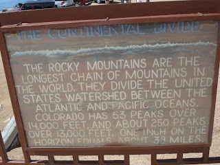
Below is an information sign at the top of Pikes Peak
Another view from the road to Pikes Peak. That's Crystal Lake in the distance.
Below are two pictures of another view from the highway with Doug and Jim. We stopped here to take in the view for a few minutes. Here we talked to a fellow biker who had ridden all the way from Montreal Canada.
 See this view of the road? Notice...no guardrails! Don't know if you can tell, but that's one steep slope next to me. Notice where I'm riding? As far away from the edge as possible!
One of the many hair pin turns on the highway. Notice the guard rail IN the turn, nowhere else!
Here we passed the timberline at 12000 ft.
Below is our campsite at Cripple Creek Colorado. We
are at 10000 ft. The highest KOA in the U.S.
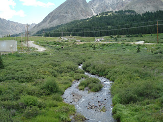
Above is the headwaters of the Arkansas River.
This is a view of the snow on the mountains as we rode across St. Rt. 24 west. This was on Friday.


No comments:
Post a Comment